Undercover Construction with DIY Flags and Mapping Apps
 Who knew a handful of tiny, colorful flags could save you thousands of dollars and a call to the utility company's emergency line? Yet here we are—modern problems, meet low-tech solutions with a high-tech twist. Whether you're a homeowner with a shovel and a dream, or a small contractor avoiding another run-in with a water main, this guide has you covered.
Why You Should Map Before You Snap
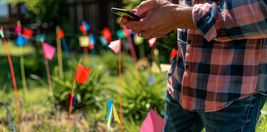
Accidentally cutting a buried cable isn't just inconvenient—it's expensive. And explaining to your partner why the internet's down because you were "just installing a new post" doesn't go over well. Marking out utilities before you dig isn't optional; it's essential. But you don't need a full survey crew and a drone to do it.You just need marking flags, a phone camera, and one of several free mapping apps. That's it. If you can stick a flag in the ground and take a photo without putting your thumb in the frame, you're qualified.
What You'll Need
- Marking flags – different colors are ideal (e.g., red for electric, blue for water, yellow for gas, purple for reclaimed water, etc.)
- Notebook or your phone's notes app
- Free mapping app (Google My Maps, Maprika, or Mapit GIS)
- Camera (your phone will do just fine)
- A little patience and maybe some caffeine
Flag It Before You Regret It
Start by identifying all known or suspected utility paths. Look for meters, boxes, sprinkler valves, or that patch of lawn that always grows like it's on performance enhancers. Once you've got your clues, place your flags along visible paths and logical lines. Keep them spaced closely enough to trace later, but not so many that your yard looks like a color-coded crime scene.Color-coding isn't mandatory, but it helps. Imagine trying to decipher your layout in three months and realizing you used the same green flag for everything. Now every buried line is Schrödinger's utility.
Map Like You Mean It
Once the flags are placed, pull out your phone and open your chosen mapping app. Most allow you to drop pins, add labels, and import photos. Walk your property, take clear photos of each flagged area, and label them as precisely as you can—"Water line, 16 inches deep," or "Gas line, avoid like your ex at a wedding."Zoom out and save a version of the map that shows the entire property. Then, make a close-up version for high-traffic zones like patios, gardens, or that future fire pit that will definitely host exactly one party before being forgotten forever.
Add notes for future-you. Your notes don't have to be formal. In fact, a little humor helps you remember. "Do not dig here unless you enjoy surprise showers" is surprisingly effective.
Backups Are for Believers
This step is often skipped, and always regretted. Back up your flagged map to the cloud or your preferred drive. If your mapping app allows for exports (like KML or KMZ files), do it. Screenshot the layout, and even print a hard copy if you're old-school or just don't trust anything that runs on lithium.While you're at it, this is also a good time to export a rel="noreferrer">bank statement to if you're budgeting for upcoming landscaping work. Staying organized digitally has side benefits beyond just safe digging.
Sprinkler Systems and Other Backyard Mysteries
Sprinkler lines are notorious for defying logic. Installed by overconfident DIYers or contractors on hour ten of a seven-hour job, they often zigzag, loop back, or disappear entirely. Use flags to mark every visible head and junction. Turn the system on and observe where water erupts like a disappointed whale—flag those too.Now map those flags, and if your sprinkler control box has zones labeled "Front," "Back," and "Who Knows," you can finally bring some order to the chaos. Add zones to your map, note water pressure quirks, and include the exact coordinates of the one head that never works no matter what you do.
Adding Notes that Matter
Details save futures. For each flag, jot down what lies beneath, estimated depth, installation year if known, and any past "incidents." ("Hit with post hole digger, Summer '21. Regret followed.") These notes help not just you, but anyone else who touches your property later—spouse, tenants, landscapers, or that friend who swears they know how to build a deck.When using mapping apps, attach these notes to corresponding pins. Apps like Mapit GIS let you input custom data fields. Don't just label something "water," label it "PVC water line, 12" deep, installed 2019, leaky joint near rose bush."
Review, Revisit, Reflag
Your map isn't a one-and-done project. Review it every time you plan a new project or see signs of line shifts—especially after heavy rain, ground settling, or that moment when your kid decides to "help" by relocating the flags. Reflag as needed, rephotograph if things have changed, and update your map accordingly.It's a living document, much like your relationship with the guy who installed your cable line an inch below the surface.
Flagging Off with Style
Laying flags and snapping photos may not feel like glamorous work, but few things are more satisfying than avoiding a catastrophe you never have to know. Mapping your underground assets is an act of foresight, one that turns your yard into a predictable space instead of a dig-and-hope minefield.Plus, when your neighbor inevitably asks how you managed to dig that trench without slicing a single cable, you'll have a good answer—and a good story.
Article kindly provided by acesupplyusa.com
Latest Articles
- Why the Most Memorable Rooms Usually Have One Thing That Feels Unexpected
- Case Study - How Much Does a New Roof Cost in Harrogate?
- Case Study - How Much Does Block Paving Cost in Derby?
- Solar Power: What Happens to Your Energy After Sunset?
- Why Your Windows Could Be Costing You More Than Your Boiler
- Choosing the Right Bit for Wood, Metal, Masonry and More
- Outdoor Furniture Survival Rules for Tropical Weather
- The Psychology of Home Heating: Why Some Houses Always Feel Cold
- Why Kitchen Cabinets Fail Long Before They Should
- Why Your Front Door Suddenly Becomes Hard to Lock
- The Psychology of Letting Go: Why It's So Hard to Clear Out a Home
- From Flat to Dimensional: Creating Depth in Residential Interior Photography
- Why Most Homes Are Over Lit - and How to Fix It Without Spending More
- Why Small Tree Problems Escalate Faster Than You Think
- How Light Changes Your Floor: Why the Same Wood Looks Completely Different in Every Room
- How to Choose a Lawn Care and Landscaping Company
- Why Sliding Doors Change How You Use a Room: Rethinking Bedroom Layouts
- Why Your Outdoor Surface Choice Matters More Than Your Furniture
- The Hidden Trade-Off Between Comfort and Grip in Outdoor Flooring
- Designing a Garden Renovation Without the Chaos
- Interior Design
- Home Improvement
- Gardening
- Home Organization
- Home Maintenance
- DIY Crafts
- Kitchen and Dining
- Bathroom Design
- Home Security
- Home Automation
- Green Living
- Home Office
- Home Decor
- Garden Design
- Pet Care
- Home Technology
- Landscaping
- Home Energy Efficiency
- Home Cleaning
- Home Safety
- Home Exterior
- Home Insulation
- Home Buying
- Home Selling
- Renting
- Tradespeople
- Garage
- Bedroom
- Painting and Decorating
- Plumbing and Drainage